The Hydro-JULES Internship Programme 2025

HJ Education logo


The Hydro-JULES internship 2025 is now OPEN. 

We are excited to be recruiting five interns to join our Hydro-JULES Internship programme! You can choose from five of our Hydro-JULES research projects (you can apply for more than one!) 

Through this programme, you'll delve deep into the scientific research sector, gaining invaluable insights and skills that will shape your academic, professional, and personal growth.  

Our science makes a real difference, enabling people and the environment to prosper, and enriching society. We are the custodians of a wealth of environmental data, collected by UKCEH and its predecessors over the course of more than 60 years.   

If you are passionate about hydrology and environmental science, the Hydro-JULES Intern Programme is the perfect opportunity to gain hands-on experience and collaborate with our team of Hydro-JULES scientists.  

Internship dates are not flexible. You must be available to work from Monday 7th July to Friday 15th of August 2025. Four of the roles are based at our Wallingford site; the fifth role is based at BGS in Keyworth.  Hybrid working will not be considered.

  • You will be receive c. £2,847 (before deductions) in total for the 6-week programme. 
  • Accommodation is NOT provided by UKCEH. Successful applicants are responsible for finding and for covering accommodation and living costs for the duration of the internship.

Eligibility
Interns must be excellent communicators, numerate and e passionate about hydrology and climate. Depending on the project, skill sets may differ, however all applicants must:

  • Have the right to live and work in the UK for the duration of the placement.
  • Be able to work full time (37 hours per week) at the appropriate site for the duration of the internship.
  • Be in undergraduate or postgraduate (including PhD) education at university.
  • Studying a relevant degree.
  • Comfortable working independently with strong communication and interpersonal skills.
  • Act a strong team player, comfortable both giving and receiving feedback openly.
     

Successful  applicants must also agree to the following:

  • Provide a one-page report to their supervisor describing the visit and its accomplishments, plus a short testimonial within 30 days of completion of the visit.
  • Agree to appear in publicity and promotion materials for UKCEH.
  • Agree to produce and present a poster, or give a presentation at a Hydro-Jules event.
  • Acknowledge the support of Hydro-JULES funds in any publications or presentations arising from the visit.

You will carry out work for UKCEH under a contract of services agreement via Hays PLC (Company Number 02150950). You will be paid weekly by Hays PLC by submitting a timesheet to your UKCEH Line Manager.

Please note: Unfortunately, we are unable to offer visa sponsorship for this role and this does not qualify for endorsement to support a Global Talent Visa application.


The Projects

Remember to specify in your cover letter which project(s) your interested in:   

Project 1 - Understanding Flood Dynamics in East African Wetlands: Insights from Observational and Model Comparisons.

Supervisors - Elizabeth Cooper (UKCEH), Sarah L Dance (NCEO / U.Reading), Sonja Folwell (UKCEH), and Visweshwaran Ramesh (NCEO / U.Reading)

Project Description:

Wetlands play a crucial role in hydrological and ecological systems, providing essential services such as flood regulation, and biodiversity support. Accurate predictions of seasonal wetland flooding are critical for managing these valuable resources and understanding their response to climatic and hydrological variability.
Numerical hydrological models can capture some aspects of wetland flooding well, but have room for improvement. At the same time, more and more satellite-based observations of wetlands, are becoming available. This project will compare outputs from an existing flood model with various satellite-derived observations, to help assess strengths and weaknesses of the model in capturing observed wetland dynamics.

The intern will work with a multidisciplinary team to evaluate the performance of hydrological model in simulating inundation over East Africa and explore observation-based methods to refine model outputs. The research will serve as a foundational step toward improving inundation models, helping to address challenges in representing large, persistently inundated wetlands. This project is an excellent opportunity for students with a background in environmental science, physics, mathematics, computer science, or engineering to develop practical skills in model analysis, satellite data use, and scientific communication.

Tasks:

  • Analyse and visualize pre-prepared model output datasets for a selected wetland region in Africa.
  • Compare model predictions of wetland water extent with satellite-derived flood extent data (e.g., from Sentinel-1 or MODIS satellites).
  • Test a variety of metrics for evaluating the agreement between model outputs and satellite observations.
  • Perform sensitivity analyses to identify key parameters or factors influencing the model’s performance.
  • Prepare a presentation and a concise technical report summarizing the methodologies, results, and recommendations.

Expected Outcomes:

  • A better understanding of the strengths and weaknesses of modelled inundation outputs for the selected case study, along with recommendations for optimizing the model for future applications in regional inundation forecasting.
  • The candidate will gain hands-on experience using satellite-derived flood extent products to evaluate and validate a hydrological model, developing critical skills in satellite data analysis.
  • A comprehensive presentation summarizing the methodologies, results, and implications for improved flood and inundation management.


Required Skills and Background:

  • Strong numerical skills, analytical and communication skills.
  • An interest in hydrology, environmental science, or a related field.
  • Experience with data analysis.
  • Familiarity with programming languages such as Python or R. Experience with a Linux environment would also be beneficial but is not essential.
     

Project 2 - Understanding Precipitation Estimates from Commercial Microwave Links 

Supervisors - Steven Cole (UKCEH), Robert Moore (UKCEH), John Wallbank (UKCEH), David Dufton (NCAS) 

Project Description
Commercial Microwave Links (CMLs) between base stations form the basic infrastructure of mobile phone networks used ubiquitously across the world. Signal attenuation due to precipitation is routinely compensated for by mobile phone operators – providing the opportunity for these links to be used as precipitation sensors. The high resolution of the link data can provide useful precipitation estimates as a complement to more conventional sensors such as raingauges and weather radar, especially where these may be sparse or subject to error. Urban areas and remote mountainous environments often have potential to benefit from use of CML data. Arguably, the greatest challenge is gaining access to CML data from the commercial companies running the mobile phone networks.  

In summer 2024, the mobile phone operator Vodafone began a pilot study to collect and make available CML precipitation estimates from across its UK network. These include blended estimates incorporating weather radar and raingauge data. The Hydrological Forecasting Group at UKCEH has developed several hydrological models used in operational flood risk forecasting and are interested in exploring the potential uses of these CML-derived data in this context; and as part of an ongoing collaboration with the National Centre for Atmospheric Science (NCAS) Radar Group on improved space-time precipitation estimation.  

An initial step is to systematically assess the accuracy of the CML precipitation estimates by calculating various measures of the error compared to a raingauge “Truth”. How does the accuracy compare to estimates from weather radar or raingauge interpolation? Are there situations where the CML-based estimates are more or less accurate? How dense is the network of links and how does this impact on accuracy at grid- and catchment-scales? What quality control has or could be performed? How does the path-integrated nature of the precipitation estimate (between base stations separated by several km) affect the accuracy? How can such data be best interpolated in space and time? Is there anything of value in the raw data?  

Depending on research outcomes, this initiative could inform future use of CML data in operational flood risk forecasting, in the Flood and Drought Research Infrastructure (FDRI) project, and lead to peer review R&D publications. 

Depending on research outcomes, this initiative could inform future use of CML data in operational flood risk forecasting, in the Flood and Drought Research Infrastructure (FDRI) project, and lead to peer review R&D publications. 

Tasks and outcomes 

  • Retrieve CML data from Vodafone’s API/dashboard. 
  • Retrieve raingauge data to support assessment. 
  • Create scripts to process, evaluate, explore, and plot data.  
  • Provide feedback to contact at Vodafone. 
  • Summarise findings and Next Steps. 

Required skills and background 

  • Interest in hydrology and novel technologies. 
  • A programming language (e.g. python or R). 
  • Data analysis and plotting skills. 

Project 3 - Understanding the impacts of climate variability on global near-natural river flows 

Supervisors: Wilson Chan (UKCEH), Amulya Chevuturi (UKCEH), Eugene Magee (UKCEH), Rachael Armitage (UKCEH) and Bastien Dieppois (Coventry University) 

Project Description
The Sixth Assessment Report of the Intergovernmental Panel on Climate Change highlights that the sustainability of many communities worldwide could face significant threats due changes in hydrological extremes (i.e., floods and droughts) and the transitions between them. Understanding observed and future trends and variability of water resources at the global scale is crucial for informing climate change adaptation. However, hydrological trends are often confounded by human disturbances, such as dams, abstraction for irrigation or domestic/industrial water use. The ROBIN project has assembled a global Reference Hydrometric Network (RHN), consisting of 3000+ near-natural catchments with quality-checked river flow measurements, some stretching back to the early 20th century. While studies have investigated the effects of large-scale climate variability on river flows, few studies have attempted to disentangle the complex influence of climate variability on hydrological regimes at near-natural catchments at the global scale.  

UKCEH researchers have begun analysing the river flow observations within the ROBIN dataset to identify trends in low flows and hydrological droughts. This project aims to expand recent analysis to characterise general river flow and flood variability, identify the influence of different modes of climate variability on flood regimes and characterise transitions between floods and droughts. The project will have collaborations and expertise from scientists within UKCEH and beyond. The specific objectives of this project are to: 

  • Characterise seasonal river flow variability across all ROBIN catchments   
  • Identify flood events and transitions between extreme flood and drought events at near-natural river catchments and compute observed trends in flood and transition metrics following established trend detection frameworks (e.g. ROBIN code library) 
  • Understand statistical relationships between river flows and modes of climate variability (e.g. El Nino Southern Oscillation, Atlantic Multi-decadal Variability) at varying time lags 

The output of this project will expand our understanding of global flood variability and contribute to evidence that would provide baseline data to help constrain future river flow and flood projections. During this project, the student will gain an understanding of hydro-meteorology, established trend detection methods, R/python programming and a flavour of academic research.

The successful candidate for this project should possess: 

  • Strong numeracy/statistical skills and effective oral and written communication abilities. Proficiency in the Python/R programming language is essential 
  • Candidates should either hold or be actively pursuing an undergraduate degree in earth/environmental sciences or a related scientific discipline.  
  • Some experience using high-performance computing (HPC) would be beneficial, but not mandatory. 

Project 4 - Modelling water resource management over the UK

Supervisors: Helen Baron (UKCEH), Virginie Keller (UKCEH)
Advisor: Amber Reynolds (UKCEH)

Water resource modelling is an area of growing significance, as a combination of climate change and population growth places increased pressure on limited freshwater resources. Key aspects of modelled water resource management (WRM) include: water withdrawals from ground and surface water sources to meet water demand (domestic, industrial, and agricultural); return flows; water transfers; and managed reservoirs. Including these processes in a hydrological or land-surface model has several benefits: it allows water resource assessments to be undertaken; the impact of anthropogenic influences on the hydrology can be explored; and simulated stream flows in heavily influenced catchments become more realistic.

Many large-scale gridded models have WRM modules, including WaterGAP [1], VIC [2], H08 [3], LPJmL [4], PCR-GLOBWB [5], WBMplus [6], GWAVA [7], CWATM [8], and, recently, JULES. These models are often run at a coarse spatial resolution, for example, our team has implemented JULES-WRM at 0.5◦ resolution over Brazil. The next challenge is to further develop the models and datasets necessary for water resource modelling at a finer spatial scale [9, 10, 11, 12, 13], so that more detailed information on water demand and availability can be provided to water users and policy makers.

Within Hydro-JULES, we are building on the current WRM functionality within the JULES model, refining the WRM module to address the coarse scale assumptions and making use of new datasets to ultimately model water resources in the UK at a 1km × 1km resolution.

In this project, initial model outputs (utilising new datasets and existing model functionality) will be explored. The objectives of this project are:

  • To compare simulated stream flows with observed data from the National River Flow Archive (NRFA) [14] (for model runs with and without WRM) to determine the impact of anthropogenic influences on stream flow over England.
  • To compare simulated water withdrawal for irrigation (as calculated within the JULES model) to estimates from the new abstraction dataset (citation), to estimate the validity of the JULES irrigation scheme in England.
  • To identify potential limitations with the current WRM module which will inform the development of a high-resolution WRM module.
  • Depending on time, there is scope to extend the project according to the interests of the student, e.g. to compare additional model outputs to observed data (soil moisture, groundwater level, etc.) to understand the impacts of anthropogenic influences on the wider hydrological system; or to explore the effects of different parameter choices within the WRM module.

A successful candidate will have:

  • Experience in using a scientific programming language for data handling and visualisation (e.g. Python or R).
  • Some experience in statistical methods for assessing goodness-of-fit.
  • Knowledge of the hydrological system, ideally including anthropogenic influences.
  • Good numerical and oral/written communication skills.
  • The candidate will gain an understanding of water resource modelling; experience analysing spatial and time-varying data; and develop key research skills including communicating science.

References
[1] J. Alcamo et al. Hydrolog. Sci. J., 48(3):317–337, 2003.
[2] B Droppers et al. Geosci. Model Dev., 13(10):5029–5052, 2020.
[3] N. Hanasaki et al. Hydrol. Earth Syst. Sci., 12(4):1027–1037, 2008.
[4] H. Biemans et al. Water resources research, 47(3), mar 2011.
[5] Y Wada et al. Water Resour Res, 48, 2012.
[6] D Wisser et al. Geophys. Res. Lett., 35(24), 2008.
[7] J. R. Meigh et al. Water Resour. Manag., 13(2):85–115, 1999.
[8] P Burek et al. Geosci. Model Dev. Discuss., 2019.
[9] N Hanasaki et al. Hydrol. Earth Syst. Sci., 26(8):1953–1975, 2022.
[10] S. Eisner and M. Fl¨orke. Geophys. Res. Abstr., 2015.
[11] Y Wada et al. J. Adv. Model. Earth Syst., 8(2):735–763, 2016.
[12] E. H. Sutanudjaja et al. Geosci. Model Dev., 11(6):2429–2453, 2018.
[13] E. F. Wood et al. Water Resour Res, 47(5), 2011.
[14] National River Flow Archive. http://nrfa.ceh.ac.uk/data/station/info/39001,
last accessed 2025-01-10.
 

Project 5 - Simulation of basin-scale groundwater drought behaviour using the British Groundwater Model

Supervisors: Marco Bianchi (BGS) , Andrew Hughes (BGS)
Location: This role will be based at the BGS offices in Keyworth.

Project Overview
The intern will use the British Groundwater Model or BGWM ( see www.bgs.ac.uk/geology-projects/environmental-modelling/british-groundwater-model/ ) to examine how droughts propagate in groundwater systems.  Working at a national scale they will focus on particular basins across Britain to understand how groundwater droughts have developed in the past.  
They will explore what might happen from differing starting conditions based on simulating historic groundwater droughts, e.g. 1975/6.  From this understanding creates a series of scenarios which can be used to understand how groundwater droughts are initiated and how they propagate across the selected basins. 
 
Intern Tasks and Outcomes

  • Familiarity with running the British Groundwater Model. 
  • Identify historic groundwater droughts.
  • Create scenarios to examine groundwater drought events, how they start and how they propagate through the system.
  • Examine the starting conditions for each drought and what this means for the drought development and propagation in the basin.

The ideal candidate will have the following skills:

  • A background and understanding of groundwater systems.
  • Groundwater modelling experience, particular USGS MODFLOW groundwater codes or similar groundwater modelling frameworks.
  • Proficiency in data processing.
  • Proficiency in Python.
  • Strong numeracy/statistical skills and effective oral and written communication abilities.
  • Good problem solving and critical thinking abilities with the ability to work effectively in a professional and collaborative environment.

Ready to Apply?

Ready to apply?

We need three things from you: 

  1. A letter of support from your supervisor, tutor, director of studies or equivalent confirming that they are content for you to undertake the proposed summer internship.
  2. A covering letter outlining your motivation for joining the programme and specifying the project(s) you're interested in, along with reasons for your choice. 
  3. A brief CV indicating your educational background, professional experience, and any publications you may have.

 Please visit our careers page on the UKCEH website, to submit your application ensuring that:

  • You meet the eligibility requirements for the role.
  • You have thoroughly reviewed the job description, paying close attention to the specific requirements for the position.
  • Remember to specify in your cover letter which project(s) your interested in
  • You are able to submit the all of the correct documentation. Incomplete applications will not be considered.

Closing date for applications: Friday, 21st February 2025 we are expecting a lot of interest, so we recommend you apply early!   

Interviews will take place between Monday 17th March and Friday 28th March 2025.

We look forward to receiving your application soon!


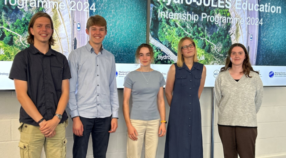
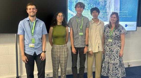
Image
Intern Group Photo

Hydro-JULES Internship Project Presentations - August 2024

This year’s interns have undertaken a wide range of research projects that have showcased the diversity of environmental science within UK CEH. With backgrounds in various academic fields, our five interns have spent the last six weeks deeply engaged in their projects. They’ve had opportunities to conduct fieldwork, create content for short films, and collaborate with experts in their research areas, develop their skills and grow their confidence.


Hydro-JULES Internship Presentations - August 2023

Our two Hydro-JULES interns completed their placements with us on 18 August by presenting their work to members of the Hydro-JULES project team.

Danny Cooper mentored by Brenda D’Acunha and Ross Morrison presented his work on ‘quantifying water productivity and carbon intensity of food and bioenergy production systems' and  Felipe Feleni, mentored by Amulya Chevuturi, Doran Khamis, Gianni Vesuviano, and Matt Fry, presented his work ‘Exploring the drivers of variability in flood events across the UK’ first.'.
Image
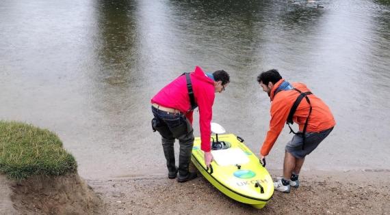
Arc Boat

Waterborne: Nick (left) and Doran launch the boat into the river Thames at Wallingford
Image
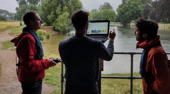
Watching the river flow: (left to right) Nick, Felipe and Doran monitor data transmitted from the ARC boat.

Watching the river flow: Nick, Felipe and Doran monitor data transmitted from the ARC boat.

I really found it useful seeing the working of the workplace with project hours etc and very much enjoyed seeing how data science and statistics is applied to different fields.
- Daniel Cooper, UEA

The project was interesting and provided an opportunity to chat with people that I knew from my PhD, as well an opportunity to meet another research environment.  Doran and Amula have been great supervisors on all matters, from technical knowledge to help with my integration with the workgroup and workplace. My advisors Gianni and Matt, have also been involved in the project  and have supported me with technical knowledge when needed.
 - Felipe Fileni, U. Newcastle

Congratulations to both Felipe and Danny for all the work they managed to achieve in their short time at UKCEH and for their excellent presentations.

For enquiries, please contact us at hydrojules@ceh.ac.uk.